


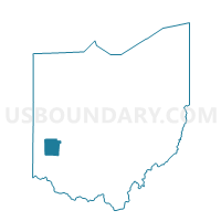
PRECINCT CENTERVILLE-J, Montgomery County, Ohio
About
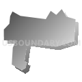
Outline

Summary
| Unique Area Identifier | 650568 |
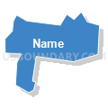
| Name | PRECINCT CENTERVILLE-J |
| County | Montgomery County |
| State | Ohio |
| Area (square miles) | 0.51 |
| Land Area (square miles) | 0.50 |
| Water Area (square miles) | 0.00 |
| % of Land Area | 99.79 |
| % of Water Area | 0.21 |
| Latitude of the Internal Point | 39.62890080 |
| Longtitude of the Internal Point | -84.12256840 |
Maps


Graphs
Select a template below for downloading or customizing gragh for PRECINCT CENTERVILLE-J, Montgomery County, Ohio


Neighbors
Neighoring Voting District (by Name) Neighboring Voting District on the Map
- PRECINCT BELLBROOK 105, Greene County, OH
- PRECINCT CENTERVILLE-Q, Montgomery County, OH
- PRECINCT CENTERVILLE-R, Montgomery County, OH
- PRECINCT CENTERVILLE-V, Montgomery County, OH
- PRECINCT CENTERVILLE-Y, Montgomery County, OH
- PRECINCT SUGARCREEK 155, Greene County, OH
Top 10 Neighboring County Subdivision (by Population) Neighboring County Subdivision on the Map
- Washington township, Montgomery County, OH (56,607)
- Sugarcreek township, Greene County, OH (8,041)
- Bellbrook city, Greene County, OH (6,943)